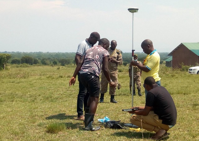
Kasese, Uganda | THE INDEPENDENT | The Ministry of Lands and Uganda Wild Life Authority (UWA) have commenced surveying and opening of boundaries between Katwe-Kabatoro town council and Queen Elizabeth National Park in Kasese district.
The exercise started with the validation of the 1952 geodetic reference frames made up of concrete pillars and proceeded to survey and confirm the boundary points. The exercise is to be conducted in Kyarukara, Rwenjubu, Top Hill, Kiganda and Kyakitale wards all in Katwe sub-county.
Queen Elizabeth National Park was gazzetted in 1952. But area leaders argue that in 1982, park officials altered the old boundary marks and crossed into the town council’s area. Katwe planning area was created in 1973.
The leaders have since petitioned the Ministry of Lands requesting for government surveyors to settle the dispute as communities continued to decry harassment from UWA officials. Earlier attempts to re-map the area in February this year ended prematurely with unexplained reasons.
The Katwe-Kabatoro mayor John Bosco Kananura says conflicts between wildlife and the community had led to the loss of life, animals and arrests. He adds that the conflict has hindered proper planning and development since the strategic area remains contested between the council and the park.
Kananura hopes that an agreement will finally be struck to aid harmony between the park, town council and the local communities for proper development.
Catherine Mbambu, the Katwe-Kabatoro town clerk says the town council is expecting investors in salt mining and hospitality industry and hopes that a final agreement will boost their confidence to know that investments won’t be subject to conflicts in the future.
Mbabu says the conflicts had also affected the communities from accessing titles and expanding for fear of being displaced.
Pontius Ezuma, the park chief warden says that unscrupulous people had started encroaching on Queen Elizabeth National Park protected area.
Dennis Obbo, the Ministry of Lands spokesperson told URN on Tuesday that the team was called in to provide expert guidance using national maps.
******
URN
 The Independent Uganda: You get the Truth we Pay the Price


